


Garmin Montana 650 Waterproof Hiking GPS, 4-inch touchscreen, 5 megapixel camera

Product Information
Specifications
Wireless connection to compatible devices
Product Description
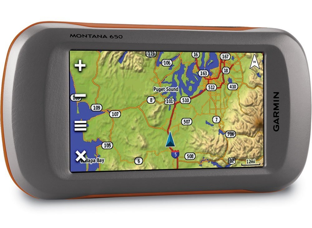
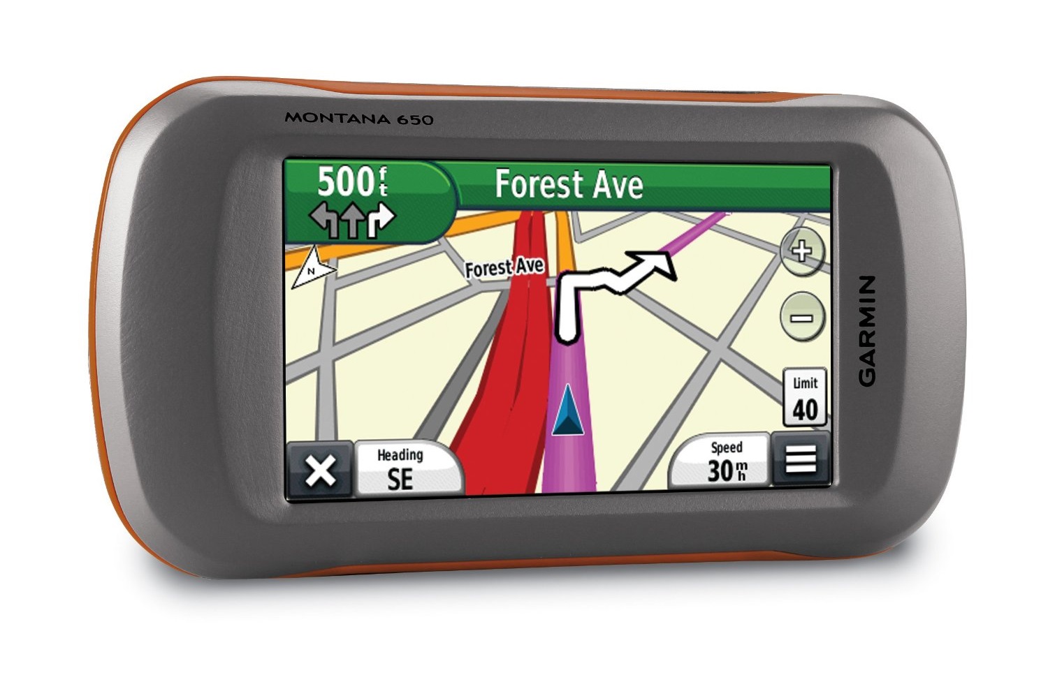
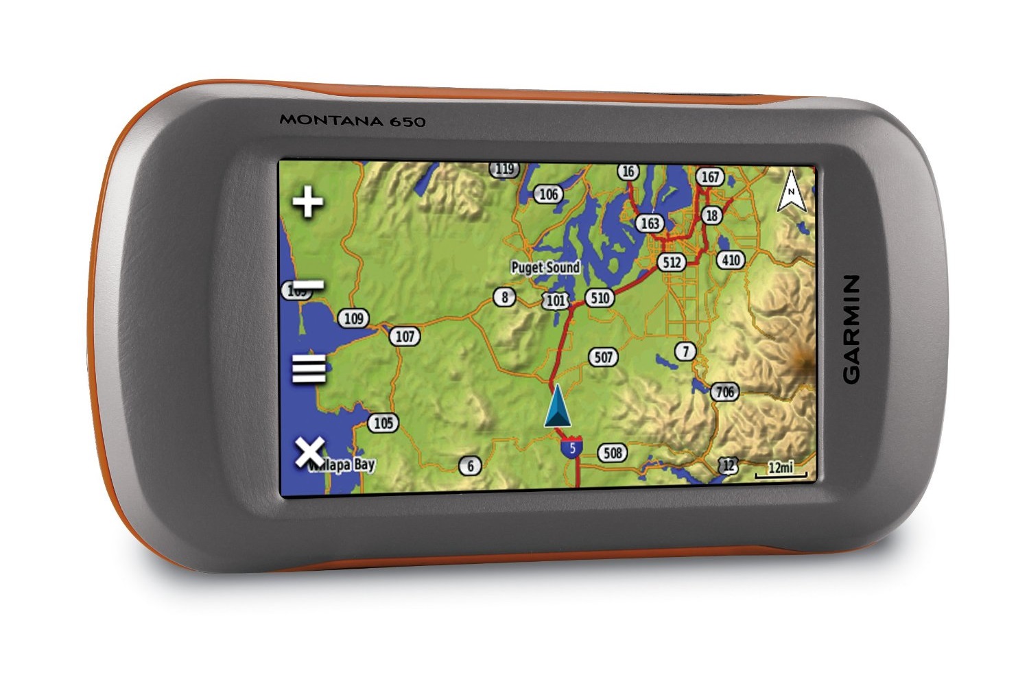
Outdoor GPS with large 4-inch sunlight readable touchscreen display and 3-axis compass. Ideal for hiking, hunting or even on the water. The Garmin Montana 650 is waterproof to 1m for 30 minutes (IPX7) and comes preloaded with worldwide basemap*.
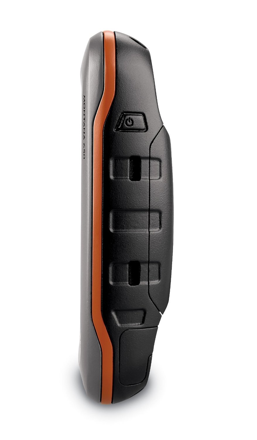
Features a microSD memory card slot so that other maps (such as automotive maps) can be added without the need for lenghtly downloads and installations.
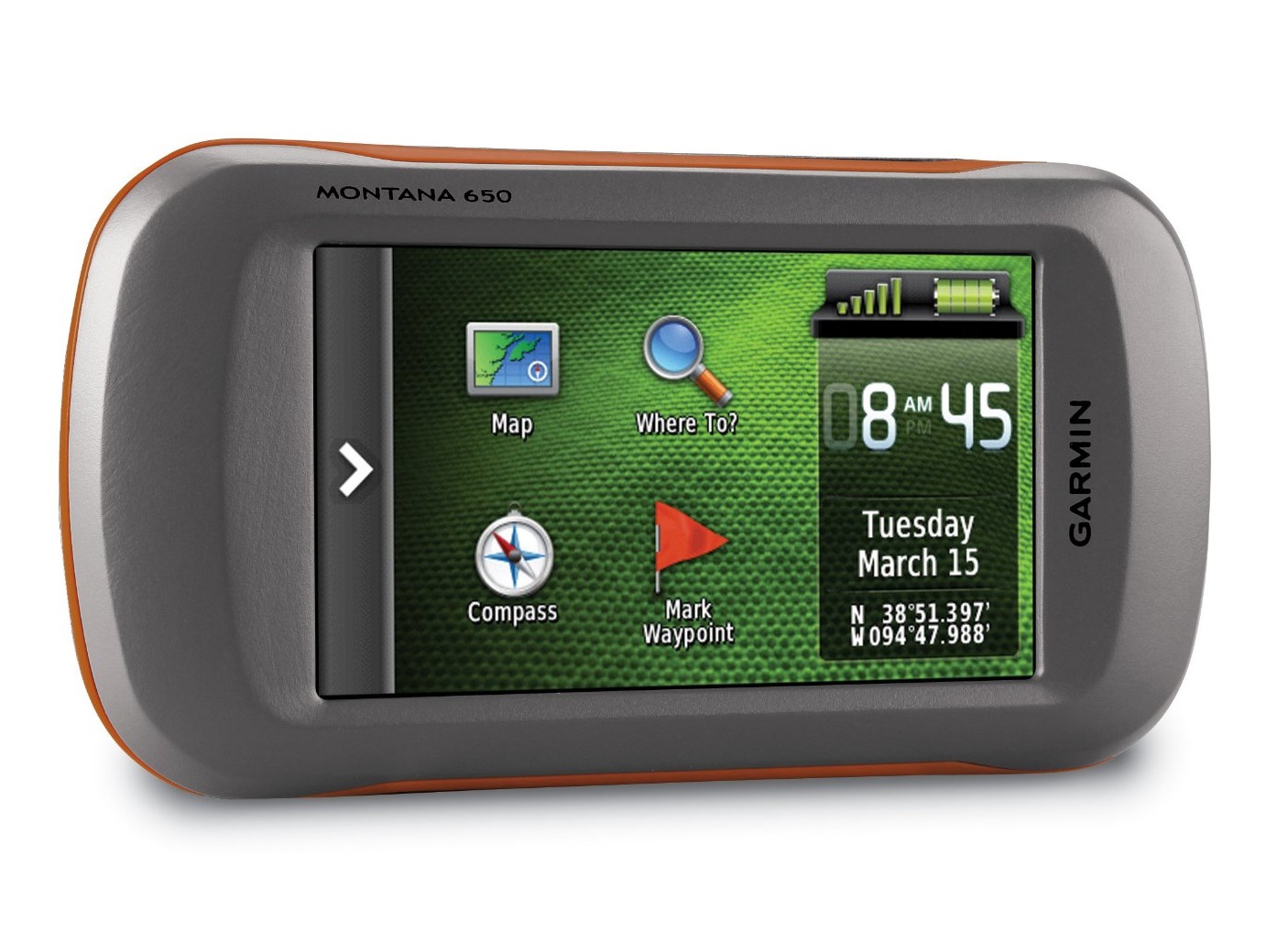
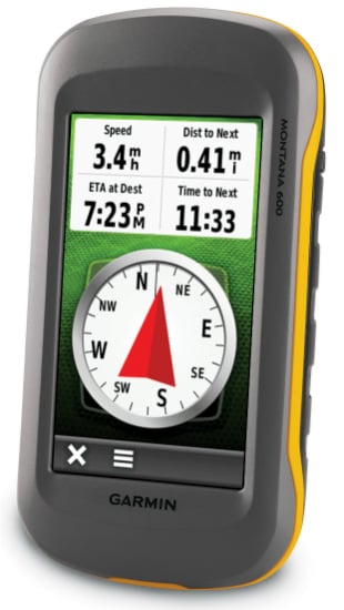
Now there’s one handheld GPS for many different activities. Whether you're on foot, on the road or on water, the new Montana 650 from Garmin will guide you wherever you go. With a vast 4” sunlight-readable touchscreen that offers crystal clear enhanced colours, dual orientation display and high sensitivity HotFix® positioning to track your location, it’s easy to see where you are at all times. Both durable and waterproof, Montana 650 is built to withstand the elements.
Navigate with Ease
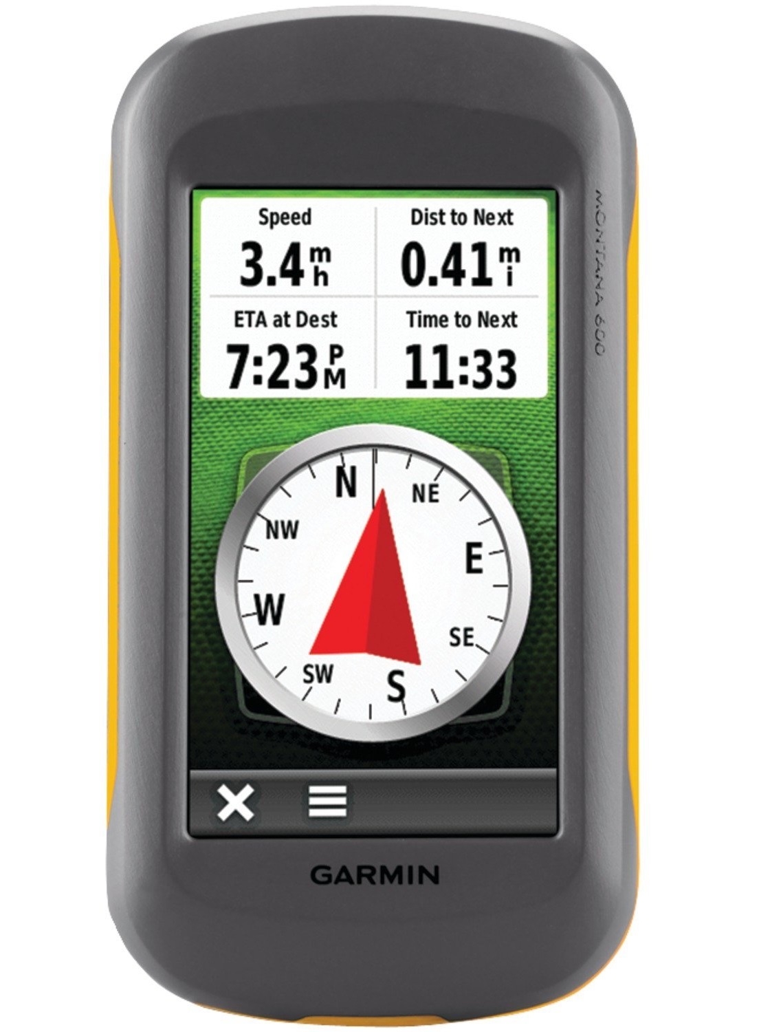
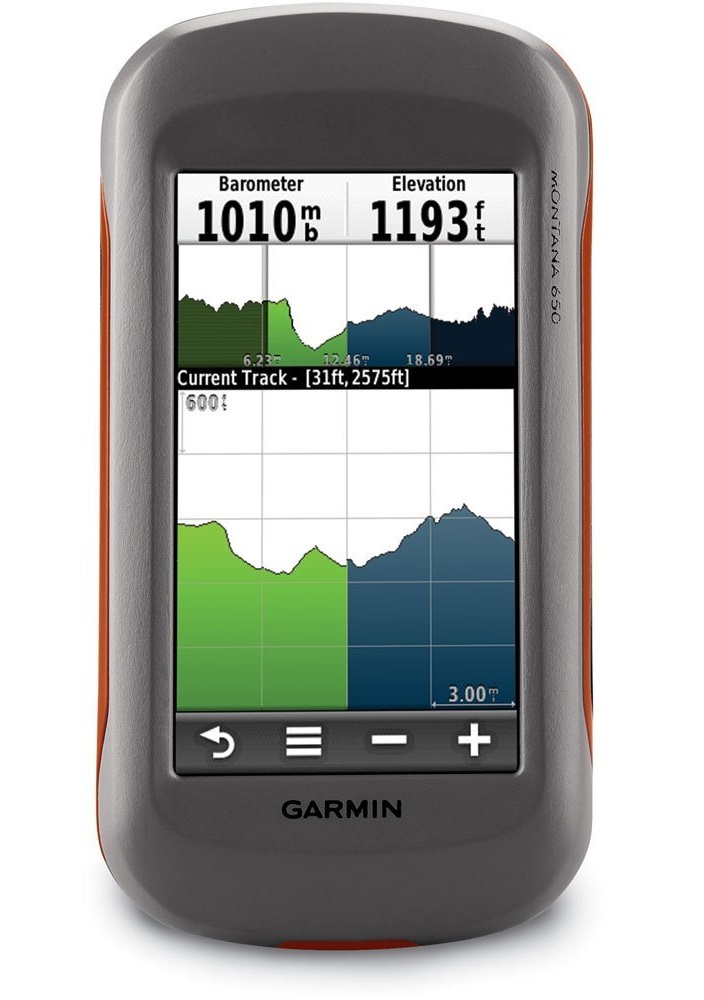
The Montana has key features for the outdoors such as a 3-axis tilt-compensated compass which shows your heading even when you’re standing still, without holding it level. It also has a barometric altimeter which tracks changes in pressure to pinpoint your precise altitude, and you can even use it to plot barometric pressure over time, which can help you keep an eye on changing weather conditions.
It's also preloaded with worldwide basemap with shaded relief.
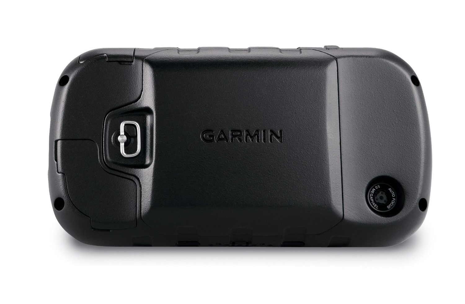
Take Geotagged pictures
Capture locations and memories with Montana 650’s 5-megapixel digital camera. Each photo is automatically geotagged with the location of where it was taken, allowing you to navigate back to that exact spot in the future. To keep track of your photos and show their location on a map, simply connect Montana 650 via USB and use Garmin’s free BaseCamp™ software to download the photo's to your PC. You can also use BaseCamp to upload them to your favourite photo sharing website.
Share Wirelessly
With Montana 650 you can share your waypoints, tracks, routes and geocaches wirelessly with other compatible Garmin GPS users. So now your friends can also enjoy your favourite hike or cache – simply press “Send” to transfer your information to other units.
Keep in charge
Montana 650 features a one-of-a-kind dual battery system. You’ll have the option of using the rechargeable lithium-ion pack or traditional AA batteries – whichever suits you best.
Try Geocaching
Montana 650 supports geocaching GPX files to download geocaches and details straight to your unit. Visit OpenCaching.com to start your geocaching adventure. Montana 650 stores and displays key information, such as location, terrain, difficulty, hints and descriptions, which means no more manually entering coordinates and paper print outs! Simply upload the GPX file to your unit and start hunting for caches.
*Note: Basemap does not contain the same level of detail as normal road maps, is it designed to show oceans, rivers, lakes, larger cities, larger roads etc. Basemaps are not suitable for automotive navigation.